
CHINESE CORRIDOR
Pakistan’s great ally China is located north of it. However, China is a vast country stretching from north of Pakistan to the east, the great coast of China. China has developed rapidly as the world’s fastest growing economy. Its GDP is growing and may reach the size of USA in a year or. In 2014, according to the CIA’s World Factbook, the GWP totaled approximately US$107.5 trillion in terms of purchasing power parity (PPP), and around US$78.28 trillion in nominal terms. USA has $ 18.57 Trillion share, compared to $ 11.2 Trillion for China. It’s already the 2nd largest economy ahead of USA.
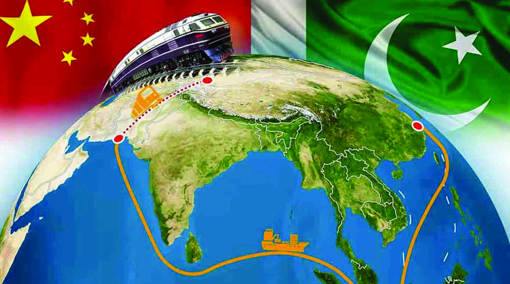
The areas of South Western China are located just north of Pakistan. The Xingjian autonomous region is linked through the Karakoram Highway to Pakistan via the Kunjerab Pass. Geographically the mouth of the Gulf opens onto the Mekran Coast / where Gwadar Port has been established. The North Arabian Sea narrows between Oman and Pakistan’s coastal belt. Gwadar / Pasni are closer to Iranian ports of Bander Abbas, Chabahar and across the sea to Oman and even Dubai, inside the Gulf, then to Indian port of Mumbai. The geographic linkage of Pakistan’s coast, with eastern Persian ports and Gulf Arabs were historical. However the opening of Pakistan’s western coastline is synergizing the geographical proximity.